- Home
- At a Glance
-
-
About Us
-
 The goal of the St. Charles Active River Project is to create a lively riverfront environment and experience that is the centerpiece of the community.
-
-
- Purpose
- News & Events
- VIDEOS
- Contact Us
Master Plan
Strategy
In order to achieve the goal to create a lively riverfront environment that is the centerpiece of the community, and to meet the stated objectives and standards, the St. Charles River Corridor Strategy is to:
-
Attractions and Destinations
Complete a package of seasonal and year round river-centric attractions and complementary destinations
Read More
-
Natural, Recreational and Cultural Assets
Embellish natural, recreational, and cultural assets
Read More
-
Connections
Complete the river, riverwalk and trail connections
Read More
-
Brand and Momentum
Refine and align brand communications. Act systematically and incrementally to gain and sustain momentum
Read More
Strategy
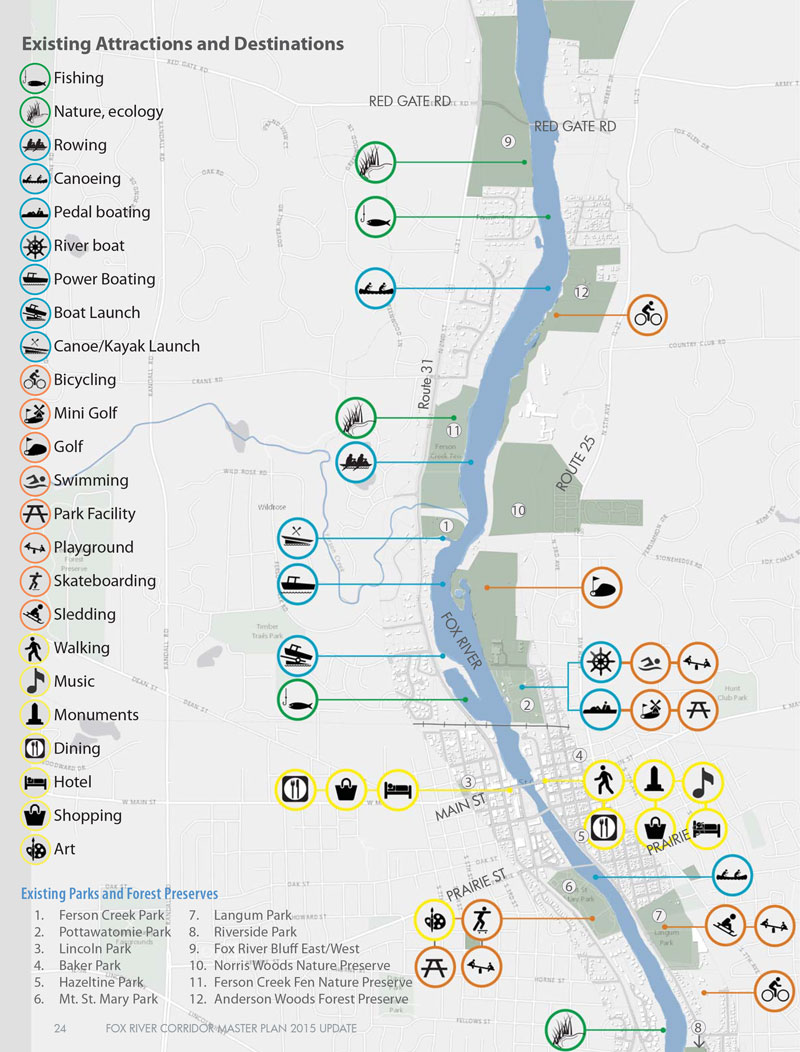
Existing Attractions and Destinations It is important to point out that there are many existing attractions and destinations located throughout the St. Charles section of the Fox River corridor that already support the overall strategy. Many of these will continue to function as they currently exist for the foreseeable future, while others will be modified or improved to advance the proposed strategy.
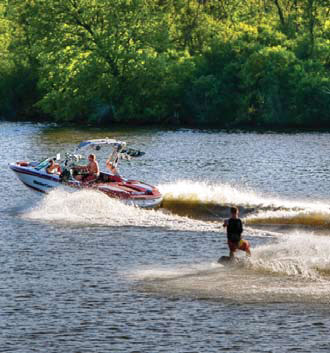
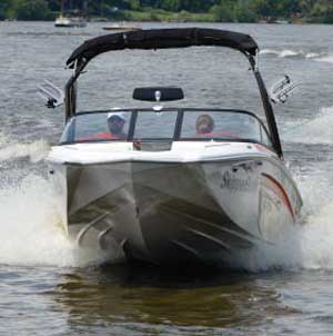
Boating on the Fox River

Rowing on the Fox River
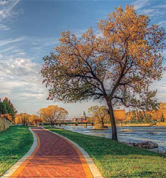
Bob Leonard Memorial Walkway

Potowatomie Park
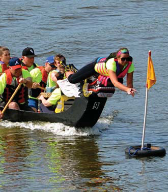
St Charles Riverfest Dragon Boat Race
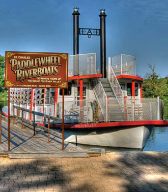
St Charles Riverboat
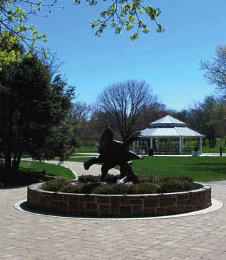
Mt St Mary Park
Map of Existing Attractions and Destinations
Attractions Attractions are significant components that draw interest, provide entertainment and contribute to the overall livelihood and viability of the place. The outlined Attractions are the best opportunities to achieve the Goal, Objectives and Standards based on the results of the Opportunity Analysis.
Support existing attractions, and:
Continuous Riverwalk
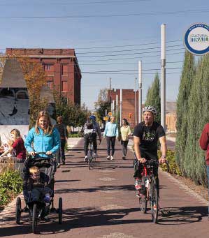
Regional Trail Connections
Whitewater Course
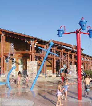
Destination Water - based Play

Signature Pedestrian Bridge
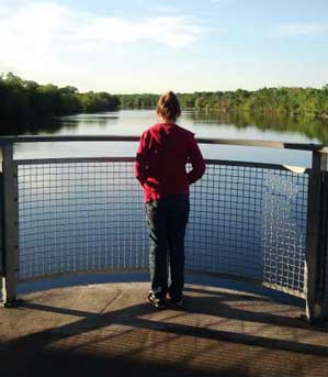
"Bridgeview" Overlook
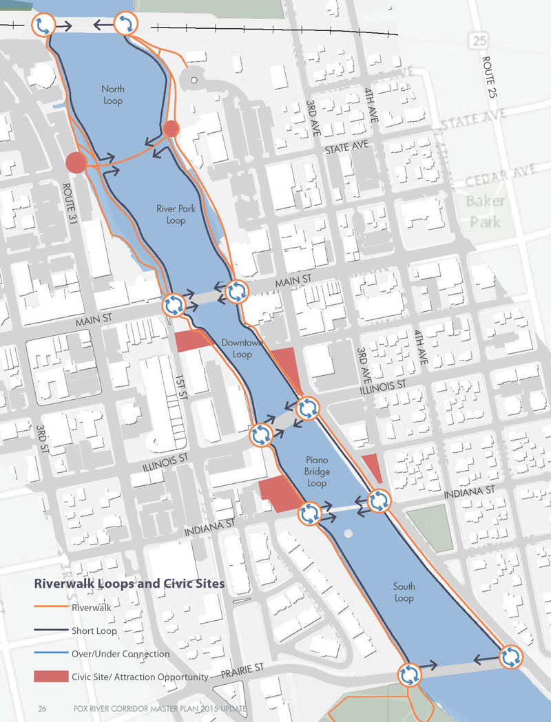
Map of Riverwalk Loops and Civic Sites
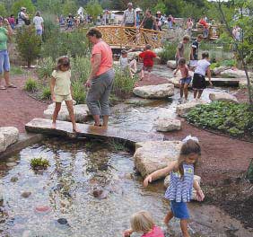 Childrens Stream and Play Area
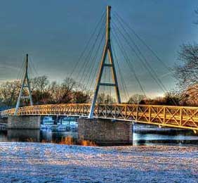 Signature Pedestrian Bridge
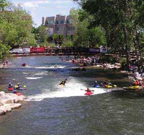 Dam Modification
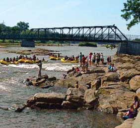 Riverwalk Observation Area
"River Park"
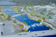
Momentum is growing to take action on the dam. Complete dam removal could improve water quality and wildlife passage, although it would result in reduction of the upstream impoundment pool, which is an undesirable result for the community. Modification of the dam is an alternative that would result in preservation of the impoundment pool while providing an opportunity to create a paddling course, a children’s exploration stream, and reclaimed land for construction of a continuous riverwalk. Add in a signature pedestrian bridge along with spectator observation areas and this area can become an incredibly unique “River Park” unlike anything else in the Fox Valley region.
Recommendations
- Modify the dam to create a series of drops and rapids that will be attractive to whitewater kayaking enthusiasts
- Create a safe passage for experienced canoeists and convenient portage locations for novices
- Maintain the upstream impoundment pool water level to accommodate existing water based activities
- Create a children’s splash depth play stream and water based play environment
- Complete a continuous riverwalk with spectator observation areas
- Complete a signature bridge connecting State Street to the east side of the river
Maintain Impoundment Pool
A drop structure located at the railroad bridge pier foundations will maintain the water elevation of the upstream impoundment pool and provide downstream safe passage for non-motorized boats. Provide transient boat tie-up access north of the railroad bridge along the Pottawatomie Park shoreline for power boater access to downtown.
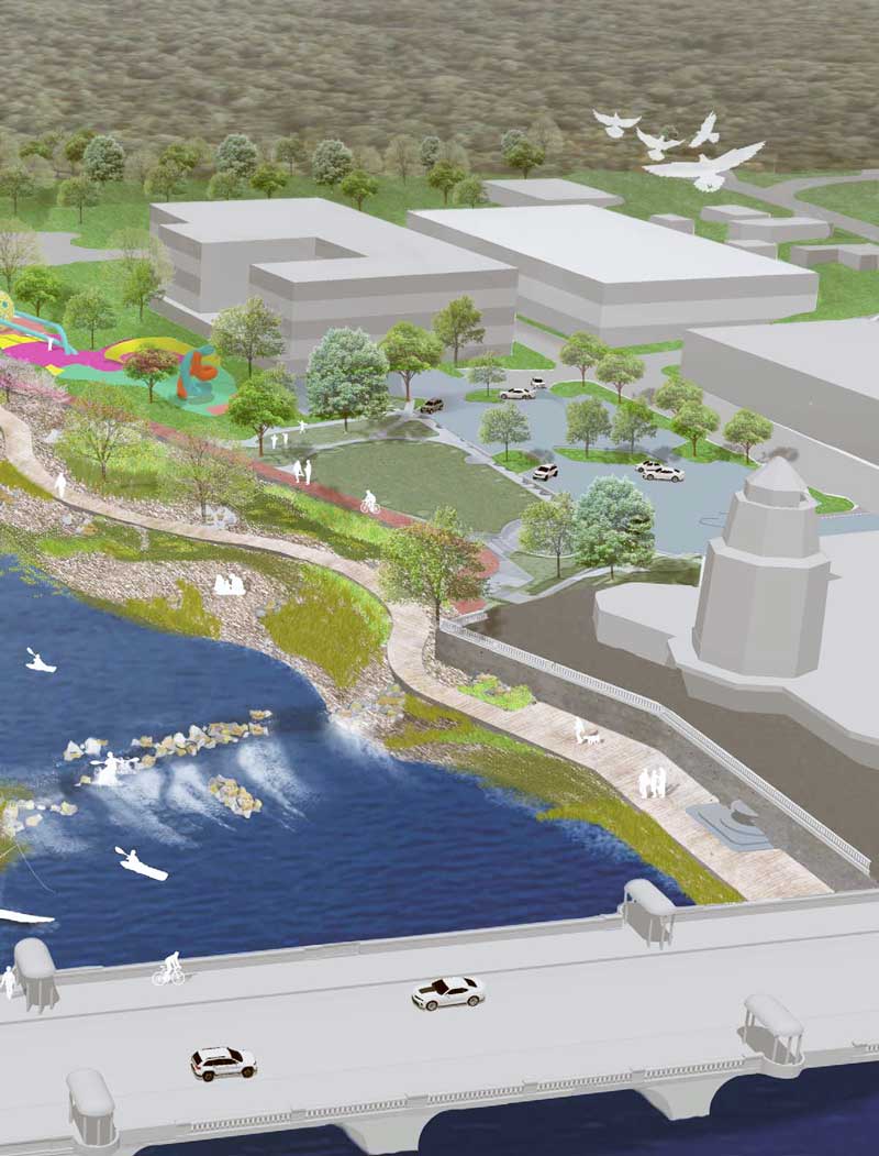
Children’s Stream and Play Area
Develop a low-flow side channel as a children’s play stream, with a nature/water based destination play area along the shoreline. Multiple locations will act as viewing areas for river based activities.
Pedestrian Bridge and Plazas
Provide a signature pedestrian bridge for east/west access and river activity viewing. Civic plazas located at each end of the pedestrian bridge will include cultural and pedestrian amenities.
Dam Modification
Remove the dam and provide multiple terraced drop structures to create a single flowing river channel. Develop various levels of experiences that will be attractive to users of all skill levels. Provide a safe passage route and easy to access put-in and take-out points.
Riverwalk and Observation Areas
Continuous riverfront access is possible on reclaimed shoreline areas. Maintain the Freedom Trail access throughout the River Park and north to Pottawatomie Park. Provide overlook and observation areas at various locations throughout the River Park.
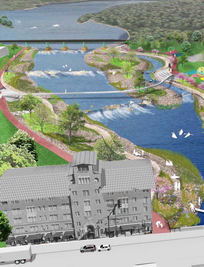
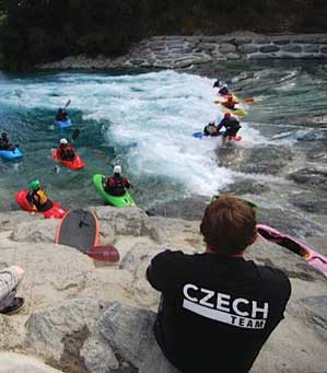
The River Park will begin at the Railroad Bridge and continue downstream of Main Street and will be a recreational environment that is designed for a variety of skill levels and user types including freestyle kayakers, river-runners, slalom kayakers, stand-up paddlers, boogie boarders, rafters, and tubers. The run will extend downstream from the railroad bridge to the existing dam structure and will be designed to maintain the existing water level of the upstream pool as a flat, slow moving impoundment ideal for flatwater rowing and paddling activities.
There will be a singular, natural fl owing river channel designed with alternating, expanded river benches and terraced step drop structures that are designed to function at a variety of water levels. The design of the park mimics a natural river system with rapids, drop structures, rock clusters, and riparian vegetation. The banks of the river will be stabilized with natural stone terracing and bio engineering techniques. The park will have a riverside trail loop with an accessible put-ins and take-outs, as well as additional river access points along the course. The park will also have a children’s play stream and beach area which will provide a place for users to interact with the river.
The design will include 4 or 5 separate drop structures that will maintain the elevation of the existing upstream pool, facilitating current water based activities, and distribute the drop of the dam. The character and form of the drop structures will vary with some drops creating waves and hydraulics ideal for freestyle kayaking and boogie boards to play in while other drop structures will create chutes, eddies, wave trains, and pools ideal for freestyle kayaking, paddle boarders, slalom boaters, surfers, and boogie boarders.
The character of the river between drops will also vary. There will be areas of slow moving water containing big pools and eddies, areas of fast moving water with riffles and waves, and boulder garden areas where paddlers are able to navigate between rocks. The variety of river features will provide a “playground” for a variety of different river users.
The River Park experience will vary seasonally and is flow dependent. During high water events, the park will offer waves and holes that could be of national caliber. A park of this size will be able to host local as well as national level events in freestyle kayaking, paddle boarding and slalom. At medium and low water levels, the park will accommodate family friendly padding experiences and will be ideal for instructional lessons, recreational paddling, family wading, and tubing.
 Amenitized Riverwalk
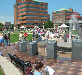 Civic Gathering Spaces
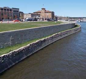 First Street Development
Riverwalk
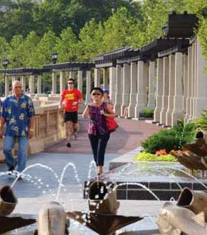
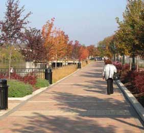
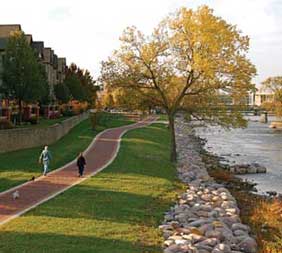
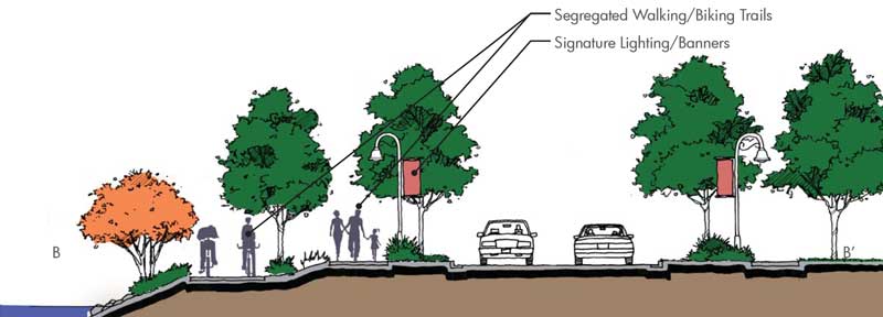
A continuous riverwalk with large and small circulation loops, unique destinations and gathering spaces, constructed with distinctive materials and amenities, will be a significant attraction for the community. The Bob Leonard Memorial walkway is a great start to completing a continuous downtown riverwalk. Continue to develop the riverwalk as public agencies invest in the riverfront, and as riverfront properties redevelop.
Recommendations
- Create a continuous riverfront circulation loop from the Union Pacific railroad bridge on the north to Prairie Street on the south
- Create a series of secondary circulation loops along both sides of the river and at each river crossing location
- Create a series of connected gathering spaces that transition into the downtown and neighborhoods
- Construct the riverwalk using distinctive materials and incorporate history, culture and art to create a unique identity
- Segregate pedestrian and bicycle traffic
- Provide grade-separated crossings where possible, and safe at-grade crossings where necessary
First Street Development
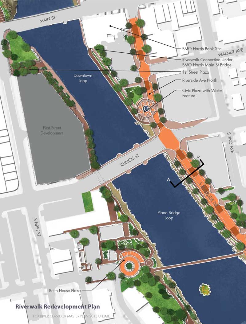
Provide continuous riverfront access along the future development. Include a civic plaza space between 1st Street and the river. Improve the at-grade pedestrian and bicycle crossings at Main Street and Illinois Street.
Beith House Plaza
Provide a civic plaza with a sculpture or fountain amenity and pedestrian amenities and furnishings. Include parking and a vehicular drop-off. Encourage private redevelopment on the adjacent property that engages the riverwalk with patios and other outdoor dining experiences
BMO Harris Bank Site
Provide a pedestrian connection along the river and under Main Street Bridge. Encourage private redevelopment of the existing property. Reorganize/reduce parking to provide pedestrian access along the riverfront and a Civic plaza with sculpture or fountain amenity. Restore/reconstruct the shoreline wall.
-
Riverwalk Redevelopment Plan
-
Riverwalk Redevelopment Plan

 Bob Leonard Memorial Walkway
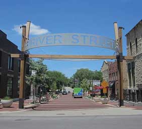 Shared Street
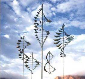 Kinetic Sculpture
Bob Leonard Memorial Walkway
Add pedestrian and walkway lighting, furnishings and pedestrian amenities. Include cultural components representing art and local history. Add trees,plantings, naturalized shoreline buffer and improve at-grade pedestrian and bicycle crossings.
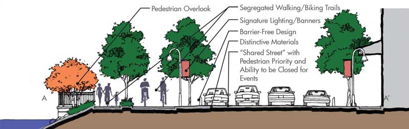
Riverside Avenue North
Divert vehicular through-traffic along 2nd Avenue to provide a “shared street” with pedestrian priority, flexibility to be closed for public events and direct riverfront access along Riverside Avenue. Include streetscape improvements continuous to Main Street including paving, lighting, trees, landscape and amenities. Provide segregated pedestrian and bicycle circulation along the riverfront with the through circulation route clearly identified. Include a civic plaza with a sculpture or fountain amenity at the Piano Factory Bridge landing. Stabilize the shoreline with naturalized restoration techniques. Encourage private development on the adjacent property.
Riverside Avenue South
Segregate pedestrian and bicycle circulation along the riverfront and stabilize the shoreline with naturalized restoration techniques. Provide pedestrian overlook/gathering spaces in various locations. Improve Hazeltine Park as a destination play environment. Implement Streetscape improvements including lighting, trees and landscape.
“In River” Improvements
Study the condition of the Piano Factory Pedestrian Bridge and determine timeline for repairs or replacement. Develop a “surf wave” south of the Indiana Street Bridge. Install a kinetic sculpture and landscaping on the existing island south of the Piano Factory Bridge. Promote temporary Art Installations on the river between Main Street and Illinois Street. Stabilize the shoreline with naturalized restoration techniques throughout.
Regional Trails
The Fox River Trail and the Great Western Trail connect to an extensive regional trail system that extends throughout the Fox River valley and beyond. The trails are already an attraction throughout the region and improvements to connect gaps, especially through downtown, along with adding clear signage, support facilities and amenities, will strengthen the system within the community and as a part of the regional system.
Recommendations
- Utilize the Union Pacific railroad bridge to connect the Great Western Trail located west of downtown, to the Prairie Path located east of downtown
- Create a series of secondary circulation loops along both sides of the river and at each river crossing location
- Create a series of connected gathering spaces that transition into the downtown and neighborhoods
- Construct the riverwalk using distinctive materials and incorporate history, culture and art to create a unique identity
- Segregate pedestrian and bicycle traffic
- Provide grade-separated crossings where possible, and safe at-grade crossings where necessary
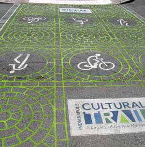 Trail Signage and Crossing
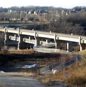 Red Gate Rd Bridge Trail Connection
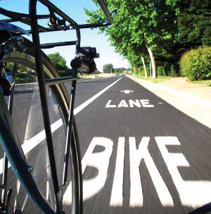 Dedicated On-Street Bike Lane
“Bridgeview”
The Union Pacific railroad bridge offers fantastic views of the river. The proximity to the River Park presents an excellent opportunity to create an observation platform in combination with the regional trail connection as a unique attraction in the community.
Recommendations
- Obtain the rights to use the existing railroad bridge and right-of-way
- Construct an observation platform in combination with the regional trail connection
- Provide pedestrian
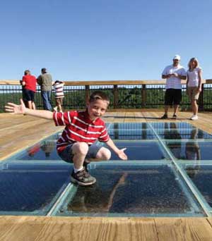 Unique Observation Platform
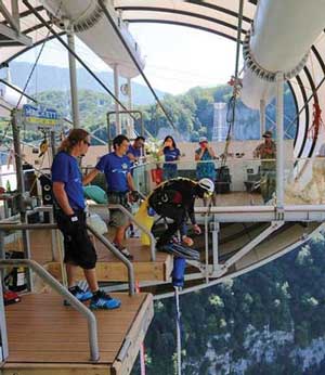 Private Vendor Services
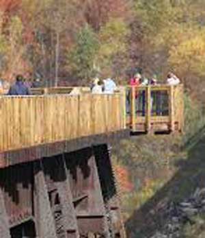 Overlook Constructed on Existing Trestle
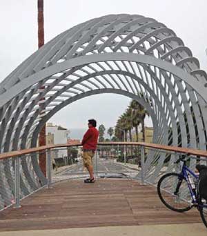 Iconic Overlook Structure
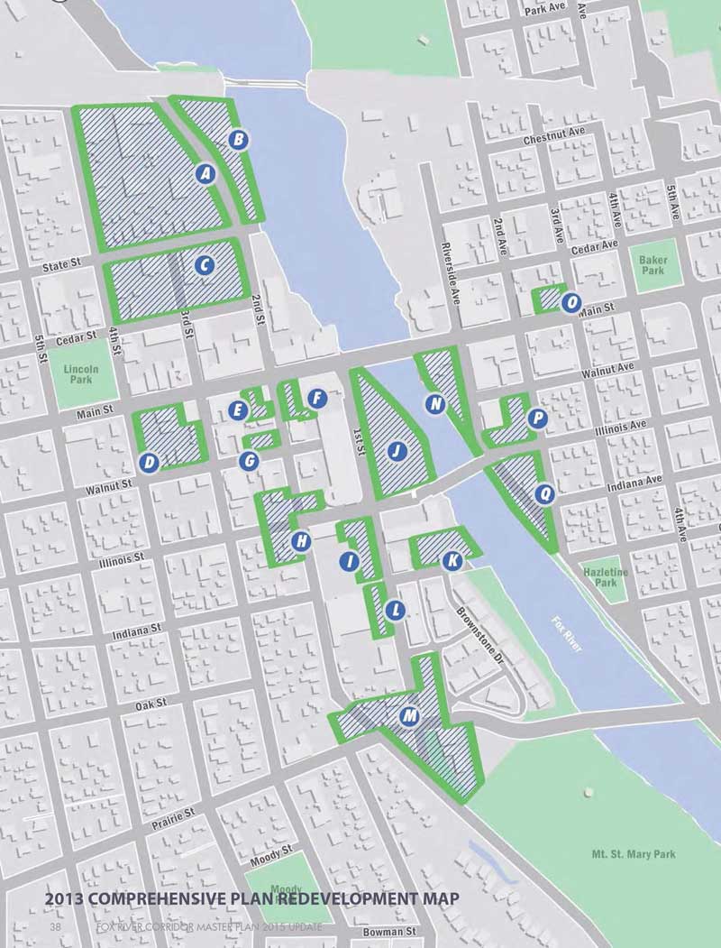
Destinations Destinations are places that offer a unique experience and people will make a special trip to visit. There are many existing destinations throughout the corridor, although the proposed destinations are complimentary to the riverfront attractions.
Promote complimentary destinations such as:
- Residential, office, hotel, retail and dining infill
- Rowing training center
- Recreational activities (climbing/ropes/zip line courses)
- Camping
- Seasonal activities (food trucks, rentals, etc)
- Electric boats/public boat docks
Residential, office, retail and dining infill
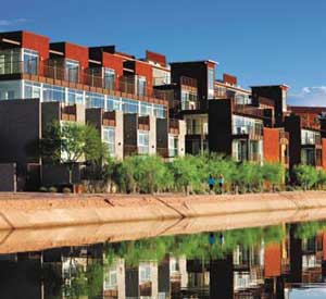 Riverfront Hotel
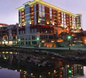 Riverfront Mixed Use Development
The proposed development of the river corridor is likely to trigger redevelopment for commercial real estate parcels in the downtown. Development is expected to happen in two-waves. The first will happen in sites with the greatest proximity to the river, while the second will happen throughout the downtown, dependant on the success of the first wave.
Success of the river redevelopment will hinge on both physical design and financial factors. Creating a pedestrian friendly and attractive downtown will attract more users, allowing for infill development to follow the initial wave of redevelopment. The scale of St Charles should also be respected so that projects will be large enough to produce financial returns without overwhelming the future demands for space.
The Police station parcel is the most attractive site for redevelopment as it will have direct access to the new river amenities. This parcel is attractive for a hotel and banquet facility as well as additional restaurants and retail.
The parcels along route 31 to the west are close enough to enjoy river views and have access to amenities but are adjacent to a residential neighborhood and are well suited for a residential product that wraps around a garage. A setback from Route 31 on the east end for a small parking lot would match the setbacks to the north and give the appearance of plenty of parking making the first floor appealing for retail.
Based on the 2013 Comprehensive Master Plan, sites “N”, “P” and “Q” could be redeveloped as a small boutique hotel, with retail and restaurant uses. While not directly on the improved stretch of the river, unlike the other parcels in town, these parcels have direct access to the new amenities.
These developments, described in more detail in the appendix, could result in total investment value of almost $210 million (preliminarily) and support more than 220 full-time-equivalent jobs in the downtown.
Rowing Training Center
Rowing is increasing in popularity on a national level and the St. Charles section of the Fox River is particularly attractive for rowing. Three rowing clubs currently utilize the river; Row America, the St. Charles Rowing Club, and Wheaton College. A shared rowing training center can serve all users and become a destination for the larger regional rowing community.
Recommendations
- Coordinate with the active rowing clubs to determine the desire and program for a community rowing training center
- Consider sites along the riverfront that could serve as a Rowing Training Center
- Establish a budget and process to advance the design, planning and construction of the Rowing Training Center
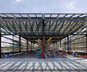 Open Air Rowing Shelter
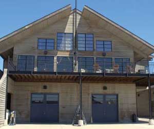 Boat House, Community Center
Camping
Camping is a complementary use for river and trail users. Similar to hotels, nearby overnight accommodations will become a destination. Interesting cabin facilities can also offer a unique nature experience for non-traditional users.
Recommendations
- Evaluate riverfront sites to determine the feasibility to provide camping
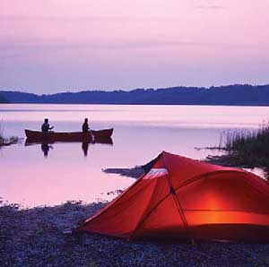 Camping in Close Proximity to River
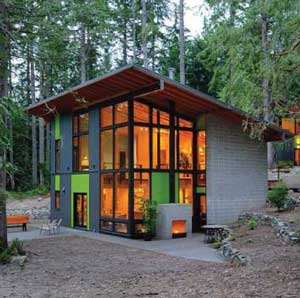 Boat House, Unique Cabin Facilities
Seasonal Activities
As active uses along the Riverfront gain in popularity, seasonal programs and activities become more economically feasible. Food trucks, vendors, equipment rentals and similar items contribute to the livelihood and popularity of the area.
Recommendations
- Determine the economic feasibility of providing seasonal programs and activities
- Recruit private entities to operate seasonal programs and activities
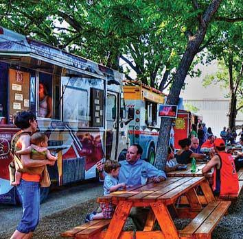 Food Trucks Offer Seasonal Dining Opportunities
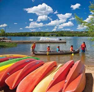 Equipment Rentals for River Related Uses
Public Boat Docks, Electric Boats
Power boating continues to be a popular activity along the river. Stakeholders expressed the desire to dock in close proximity to the downtown on a temporary basis. Paddle boating is offered from Pottawatomie Park, but electric boats would offer a fun alternative for passive users to gain access to the water
Recommendations
- Explore the possibility to provide docking facilities at Pottawatomie Park
- Explore the possibility to provide electric boats either through the Park District or as a private operator
 Food Trucks Offer Seasonal Dining Opportunities
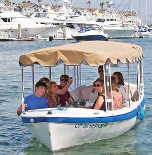 Equipment Rentals for River Related Uses